In January this year, I began training for a section of the AT with a group of about 12 former military service men and women. I was grateful they invited me into their group since I never served (but my husband and son do!). Two days before the hike was to begin, it was abruptly cancelled (the three leaders all had separate emergencies come up).
One of the hikers sent out a group text at the same time I did asking "Who still wants to go?". No one else chimed in, so we texted each other and decided to go ourselves.
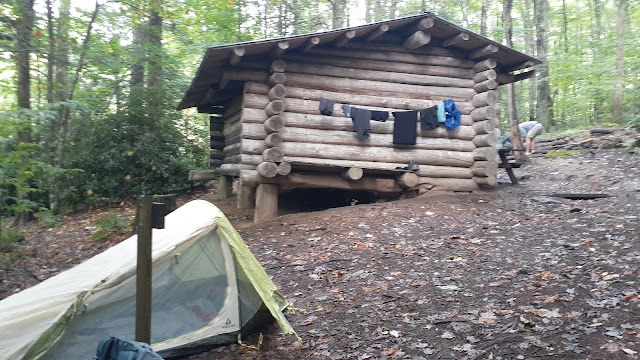
We kept the original itinerary and drove to the starting point...Lemon Gap on the border between NC and TN. Similar to the Foothills Trail, we followed the white blazes on the trees. The AT never crosses paths with the Foothills, so both can use the same color. Our first day was a short hike about 3.5 miles to Roaring Fork shelter. This one was really nice. There were three other hikers already there, so that made for fun evening conversation about where everyone was from and where they were headed. All of us slept in tents since the weather was good.
The outhouse facility (or privy) was a comfort not usually found on the trail. Bring your own toilet paper, though!
Day 2 was about 8.5 miles of mostly downhill. My knees and legs were so sore! I'd much rather hike uphill than down. The terrain was very different this day than the previous day.
Where the trail didn't offer a large tree for a white blaze, we looked for sticks painted with a white mark to make sure we were still headed in the right direction.
Finally we arrived at the shelter, or almost. It was another quarter of a mile downhill from the AT. Each shelter had a bear box, which was nice. That allowed us to safely store our food and trash without hanging it over a large tree branch away from camp. There were plenty of water sources along the trail, too.
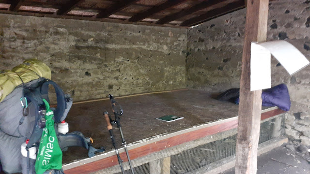
This campsite was a bit older... built in 1939. We were the only hikers who stayed at this site.
Inside, there is a place to set your sleep mat and sleeping bag. When it's raining, you could fit about 10 campers all in a row in here. Most opt for their own tent when it's nice outside to allow for more personal space and privacy. Plus, there are sometimes mice that will crawl on you in the shelter. Along the AT, each shelter also has a "journal" where hikers will jot down a note for future hikers. Sometimes it's an uplifting and encouraging message, other times a confession of sobriety, and others just a comic relief of a story they expeienced on the trail. Since neither of us thought to bring a pen, we didn't sign it.
On Day 3, our last day, we trekked 12 miles over the beautiful Max Patch. It was an exhausting 3,800 ft elevation gain (cummulative). But I was happy to be hiking uphill rather than downhill.
The views were worth it!
Once on the top, we enoyed clear mountain views of the entire 360○ area.
We enjoyed a lunch break, soaking in the views.
Eventually, it was time to head back down.
After we returned to the car, we were ready for a shower and a bed back in our homes. I enjoyed the time to unplug, smell the pines, and taste the fresh stream waters. I also got to know a wonderful lady who I'd hike again with anytime! But as far as a goal to hike the entire AT? Maybe I could do it in sections. I'd miss my family and home too much to do the whole thing at one time.


.jpg)


